
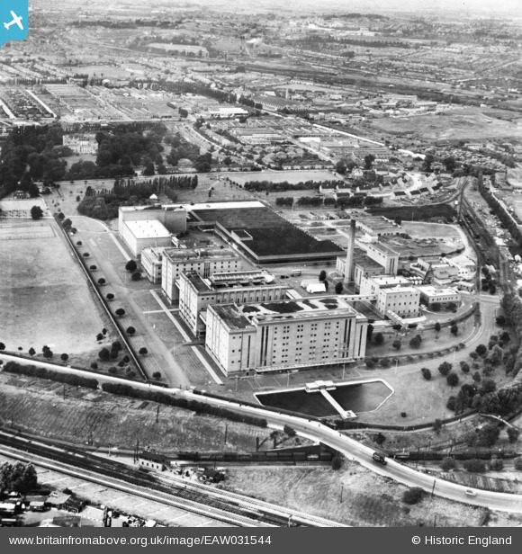
EAW031544 ENGLAND (1950). The Guinness Brewery, Park Royal, 1950. This image has been produced from a print.
© Copyright OpenStreetMap contributors and licensed by the OpenStreetMap Foundation. 2026. Cartography is licensed as CC BY-SA.
Nearby Images (48)
EAW031544

EPW041844

EPW055718

EAW031549

EAW031546

EAW031551

EPW041852

EPW041859

EAW031552

EAW031554

EAW031553

EAW031548

EPW041850

EPW041851

EAW031543

EPW048434

EAW031547

EPW041856

EPW048435

EPW041860

EAW031542

EPR000519

EAW031545

EPW041857

EAW031555

EAW031550

EPW041849

EPW041854

EPW041855

EPR000520

EPW055630

EPW033807

EAW017049

EPW033751

EPW033805

EPW055633

EAW017047

EAW017046

EPW033809

EPW033806

EAW017050

EPW033748

EPW033808

EPW055631

EAW017048

EPW041848

EPW052702

EPW041910

Details
| Title | [EAW031544] The Guinness Brewery, Park Royal, 1950. This image has been produced from a print. |
| Reference | EAW031544 |
| Date | 31-July-1950 |
| Link | |
| Place name | PARK ROYAL |
| Parish | |
| District | |
| Country | ENGLAND |
| Easting / Northing | 519314, 182716 |
| Longitude / Latitude | -0.27973140196566, 51.53025010954 |
| National Grid Reference | TQ193827 |
Pins

Sparky |
Thursday 7th of September 2017 06:49:50 PM | |

colsouth111 |
Tuesday 28th of October 2014 05:44:41 PM |