
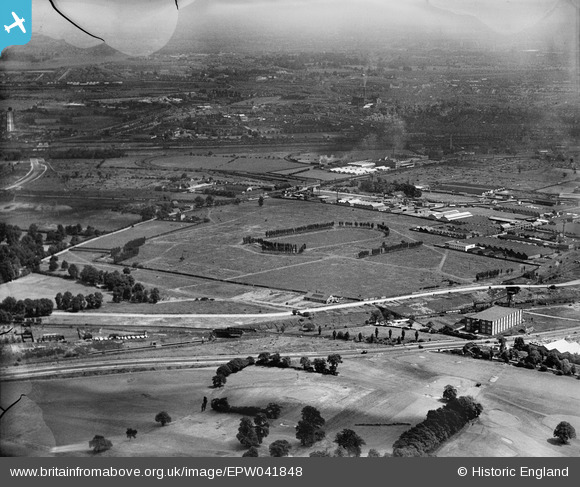
EPW041848 ENGLAND (1933). The Horse Ring football ground, Park Royal, from the south-west, 1933. This image has been produced from a damaged negative.
© Copyright OpenStreetMap contributors and licensed by the OpenStreetMap Foundation. 2026. Cartography is licensed as CC BY-SA.
Nearby Images (23)
EPW041848

EPW041910

EPW041913

EPW041912

EPR000520

EAW031543

EAW031548

EAW031545

EAW031553

EPR000519

EAW031542

EAW031550

EAW031546

EPW055718

EPW041911

EAW031547

EPW048434

EAW031551

EAW031544

EPW041914

EPW041844

EAW031554

EPW041859

Details
| Title | [EPW041848] The Horse Ring football ground, Park Royal, from the south-west, 1933. This image has been produced from a damaged negative. |
| Reference | EPW041848 |
| Date | June-1933 |
| Link | |
| Place name | PARK ROYAL |
| Parish | |
| District | |
| Country | ENGLAND |
| Easting / Northing | 519105, 182554 |
| Longitude / Latitude | -0.28279810296738, 51.528838120337 |
| National Grid Reference | TQ191826 |
Pins

gBr |
Friday 5th of May 2023 09:43:58 PM | |
|
Leslie B |
Tuesday 23rd of February 2016 12:52:17 AM | |

Class31 |
Wednesday 19th of August 2015 11:39:14 AM | |
|
Class31 |
Wednesday 19th of August 2015 09:08:48 AM |
