
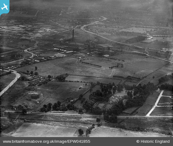
EPW041855 ENGLAND (1933). The Horse Ring football ground, Park Royal, 1933
© Copyright OpenStreetMap contributors and licensed by the OpenStreetMap Foundation. 2026. Cartography is licensed as CC BY-SA.
Nearby Images (23)
EPW041855

EPW041854

EPW041849

EAW031555

EPW041856

EPW041857

EPW041851

EPW052702

EAW031552

EPW041859

EPW041860

EAW031554

EPW041852

EPW041850

EPW041844

EPW048435

EAW031549

EAW031544

EPW055718

EAW031553

EPW033746

EAW017052

EPW033749

Details
| Title | [EPW041855] The Horse Ring football ground, Park Royal, 1933 |
| Reference | EPW041855 |
| Date | June-1933 |
| Link | |
| Place name | PARK ROYAL |
| Parish | |
| District | |
| Country | ENGLAND |
| Easting / Northing | 519396, 182905 |
| Longitude / Latitude | -0.27848560798619, 51.531931579396 |
| National Grid Reference | TQ194829 |
