
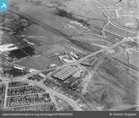
EPW060845 ENGLAND (1939). The Bromford Tube Co Works, the Birmingham Race Course and the surrounding residential area, Bromford, 1939
© Hawlfraint cyfranwyr OpenStreetMap a thrwyddedwyd gan yr OpenStreetMap Foundation. 2026. Trwyddedir y gartograffeg fel CC BY-SA.
Delweddau cyfagos (15)
EPW060845

EPW060842

EPW060844

EPW060846

EPW060841

EPW060847

EPW060838

EPW060848

EPW060839

EPW035903

EPW060840

EPW060843

EPW035904

EPW031996

EPW015255

Manylion
| Pennawd | [EPW060845] The Bromford Tube Co Works, the Birmingham Race Course and the surrounding residential area, Bromford, 1939 |
| Cyfeirnod | EPW060845 |
| Dyddiad | 25-April-1939 |
| Dolen | |
| Enw lle | BROMFORD |
| Plwyf | |
| Ardal | |
| Gwlad | ENGLAND |
| Dwyreiniad / Gogleddiad | 411561, 289901 |
| Hydred / Lledred | -1.8296508052055, 52.506515607827 |
| Cyfeirnod Grid Cenedlaethol | SP116899 |
Pinnau
Byddwch y cyntaf i ychwanegu sylw at y ddelwedd hon!