
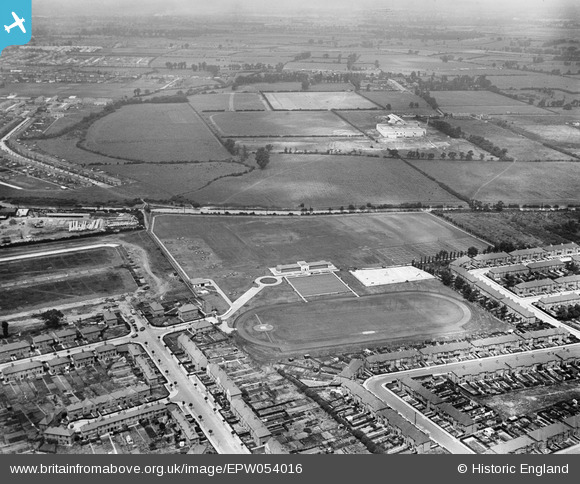
EPW054016 ENGLAND (1937). Southall Municipal Sports Ground and environs, Southall, from the south-east, 1937
© Hawlfraint cyfranwyr OpenStreetMap a thrwyddedwyd gan yr OpenStreetMap Foundation. 2025. Trwyddedir y gartograffeg fel CC BY-SA.
Delweddau cyfagos (8)
EPW054016

EPW054015

EPW054020

EPW054014

EPW054013

EPW054018

EPW054019

EPW054017

Manylion
| Pennawd | [EPW054016] Southall Municipal Sports Ground and environs, Southall, from the south-east, 1937 |
| Cyfeirnod | EPW054016 |
| Dyddiad | June-1937 |
| Dolen | |
| Enw lle | SOUTHALL |
| Plwyf | |
| Ardal | |
| Gwlad | ENGLAND |
| Dwyreiniad / Gogleddiad | 512536, 181094 |
| Hydred / Lledred | -0.37793137984948, 51.517062097219 |
| Cyfeirnod Grid Cenedlaethol | TQ125811 |
Pinnau

Mozzy |
Monday 31st of October 2016 07:42:10 PM | |
That's where I buried my first victim. Later on I became a local councillor and, with planning permission, made sure the evidence was covered up forever by B&Q. |
Eamonn |
Friday 20th of August 2021 08:00:25 PM |
|
Mozzy |
Monday 31st of October 2016 07:40:55 PM | |
|
Mozzy |
Monday 31st of October 2016 07:33:24 PM |