
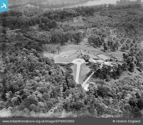
EPW053892 ENGLAND (1937). Fort Belvedere and Belvedere Wood, Wentworth, 1937
© Hawlfraint cyfranwyr OpenStreetMap a thrwyddedwyd gan yr OpenStreetMap Foundation. 2026. Trwyddedir y gartograffeg fel CC BY-SA.
Delweddau cyfagos (8)
EPW053892

EPW053893

EPW046523

EPW026170

EPW046525

EPW026173

EPW026171

EPW026172

Manylion
| Pennawd | [EPW053892] Fort Belvedere and Belvedere Wood, Wentworth, 1937 |
| Cyfeirnod | EPW053892 |
| Dyddiad | 25-June-1937 |
| Dolen | |
| Enw lle | WENTWORTH |
| Plwyf | |
| Ardal | |
| Gwlad | ENGLAND |
| Dwyreiniad / Gogleddiad | 496604, 168207 |
| Hydred / Lledred | -0.61101469794347, 51.404159134997 |
| Cyfeirnod Grid Cenedlaethol | SU966682 |
