
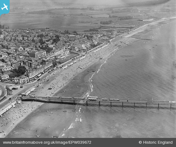
EPW039672 ENGLAND (1932). Sandown Bay and part of the pier, Sandown, from the south, 1932
© Hawlfraint cyfranwyr OpenStreetMap a thrwyddedwyd gan yr OpenStreetMap Foundation. 2026. Trwyddedir y gartograffeg fel CC BY-SA.
Delweddau cyfagos (17)
EPW039672

EAW038582

EAW038580

EPW023080

EAW022215

EPW039670

EAW022219

EPW023085

EPW023083

EAW038583

EPW023084

EPW043028

EPW023081

EPW039671

EPW043023

EPW043029

EAW022216

Manylion
| Pennawd | [EPW039672] Sandown Bay and part of the pier, Sandown, from the south, 1932 |
| Cyfeirnod | EPW039672 |
| Dyddiad | 12-August-1932 |
| Dolen | |
| Enw lle | SANDOWN |
| Plwyf | SANDOWN |
| Ardal | |
| Gwlad | ENGLAND |
| Dwyreiniad / Gogleddiad | 459886, 83991 |
| Hydred / Lledred | -1.1527885137851, 50.651936819607 |
| Cyfeirnod Grid Cenedlaethol | SZ599840 |
