
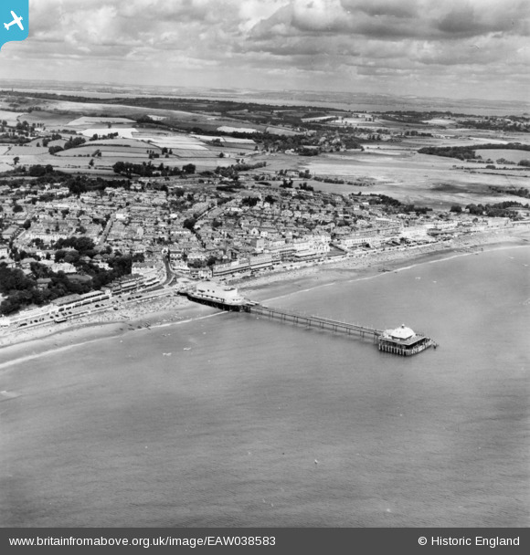
EAW038583 ENGLAND (1951). Sandown Pier and the town, Sandown, from the south, 1951. This image has been produced from a print.
© Hawlfraint cyfranwyr OpenStreetMap a thrwyddedwyd gan yr OpenStreetMap Foundation. 2026. Trwyddedir y gartograffeg fel CC BY-SA.
Delweddau cyfagos (16)
EAW038583

EAW038580

EPW023084

EAW038582

EAW022215

EPW023080

EPW039672

EPW043029

EPW039671

EAW022216

EPW023085

EPW043023

EPW023083

EAW022219

EPW043028

EPW039670

Manylion
| Pennawd | [EAW038583] Sandown Pier and the town, Sandown, from the south, 1951. This image has been produced from a print. |
| Cyfeirnod | EAW038583 |
| Dyddiad | 13-August-1951 |
| Dolen | |
| Enw lle | SANDOWN |
| Plwyf | SANDOWN |
| Ardal | |
| Gwlad | ENGLAND |
| Dwyreiniad / Gogleddiad | 459855, 83875 |
| Hydred / Lledred | -1.1532457757452, 50.650896838233 |
| Cyfeirnod Grid Cenedlaethol | SZ599839 |
Pinnau
Byddwch y cyntaf i ychwanegu sylw at y ddelwedd hon!