
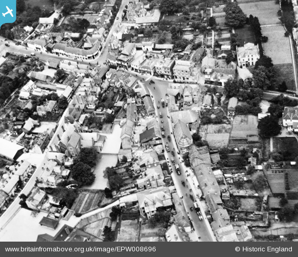
EPW008696 ENGLAND (1923). The High Street and town centre, Ewell, 1923. This image has been produced from a copy-negative.
© Hawlfraint cyfranwyr OpenStreetMap a thrwyddedwyd gan yr OpenStreetMap Foundation. 2026. Trwyddedir y gartograffeg fel CC BY-SA.
Delweddau cyfagos (11)
EPW008696

EPW028293

EPW008674

EPW008684

EPW008688

EPW028295

EPW028294

EPW007915

EPW006246

EPW006434

EPW028289

Manylion
| Pennawd | [EPW008696] The High Street and town centre, Ewell, 1923. This image has been produced from a copy-negative. |
| Cyfeirnod | EPW008696 |
| Dyddiad | 1923 |
| Dolen | |
| Enw lle | EWELL |
| Plwyf | |
| Ardal | |
| Gwlad | ENGLAND |
| Dwyreiniad / Gogleddiad | 522006, 162535 |
| Hydred / Lledred | -0.24789384865916, 51.348280321741 |
| Cyfeirnod Grid Cenedlaethol | TQ220625 |
Pinnau
Byddwch y cyntaf i ychwanegu sylw at y ddelwedd hon!