
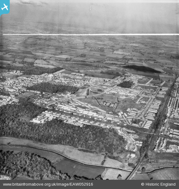
EAW052916 ENGLAND (1953). The residential area surrounding Dilkes Park, Brannett's Wood and Broxburn Drive, South Ockendon, from the south-east, 1953. This image was marked by Aerofilms Ltd for photo editing.
© Hawlfraint cyfranwyr OpenStreetMap a thrwyddedwyd gan yr OpenStreetMap Foundation. 2026. Trwyddedir y gartograffeg fel CC BY-SA.
Delweddau cyfagos (8)
EAW052916

EAW052919

EAW052920

EAW052915

EPW026358

EAW052918

EAW052930

EAW052917

Manylion
| Pennawd | [EAW052916] The residential area surrounding Dilkes Park, Brannett's Wood and Broxburn Drive, South Ockendon, from the south-east, 1953. This image was marked by Aerofilms Ltd for photo editing. |
| Cyfeirnod | EAW052916 |
| Dyddiad | 3-November-1953 |
| Dolen | |
| Enw lle | SOUTH OCKENDON |
| Plwyf | |
| Ardal | |
| Gwlad | ENGLAND |
| Dwyreiniad / Gogleddiad | 558778, 180551 |
| Hydred / Lledred | 0.28785743574252, 51.501078673288 |
| Cyfeirnod Grid Cenedlaethol | TQ588806 |
Pinnau
Byddwch y cyntaf i ychwanegu sylw at y ddelwedd hon!