
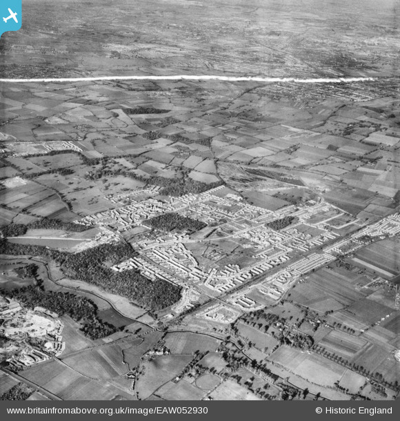
EAW052930 ENGLAND (1953). Belhus Park and the residential area alongside Dilkes Park and Brannett's Wood, South Ockendon, from the south-east, 1953. This image was marked by Aerofilms Ltd for photo editing.
© Hawlfraint cyfranwyr OpenStreetMap a thrwyddedwyd gan yr OpenStreetMap Foundation. 2026. Trwyddedir y gartograffeg fel CC BY-SA.
Delweddau cyfagos (4)
EAW052930

EAW052916

EAW052920

EAW052929

Manylion
| Pennawd | [EAW052930] Belhus Park and the residential area alongside Dilkes Park and Brannett's Wood, South Ockendon, from the south-east, 1953. This image was marked by Aerofilms Ltd for photo editing. |
| Cyfeirnod | EAW052930 |
| Dyddiad | 3-November-1953 |
| Dolen | |
| Enw lle | SOUTH OCKENDON |
| Plwyf | |
| Ardal | |
| Gwlad | ENGLAND |
| Dwyreiniad / Gogleddiad | 558997, 180659 |
| Hydred / Lledred | 0.29105901427632, 51.501987517191 |
| Cyfeirnod Grid Cenedlaethol | TQ590807 |
