
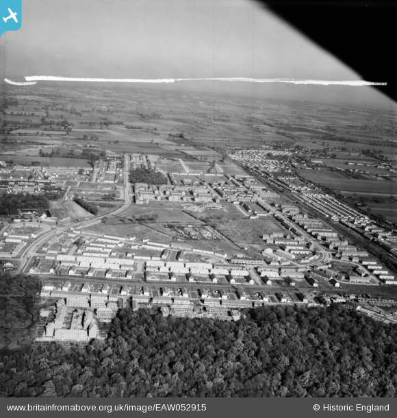
EAW052915 ENGLAND (1953). The residential area surrounding Afton Drive, Broxburn Drive and Stifford Road, South Ockendon, from the south, 1953. This image was marked by Aerofilms Ltd for photo editing.
© Hawlfraint cyfranwyr OpenStreetMap a thrwyddedwyd gan yr OpenStreetMap Foundation. 2026. Trwyddedir y gartograffeg fel CC BY-SA.
Delweddau cyfagos (6)
EAW052915

EAW052919

EAW052916

EAW052920

EPW026358

EAW052917

Manylion
| Pennawd | [EAW052915] The residential area surrounding Afton Drive, Broxburn Drive and Stifford Road, South Ockendon, from the south, 1953. This image was marked by Aerofilms Ltd for photo editing. |
| Cyfeirnod | EAW052915 |
| Dyddiad | 3-November-1953 |
| Dolen | |
| Enw lle | SOUTH OCKENDON |
| Plwyf | |
| Ardal | |
| Gwlad | ENGLAND |
| Dwyreiniad / Gogleddiad | 558708, 180664 |
| Hydred / Lledred | 0.28690050472504, 51.502113678082 |
| Cyfeirnod Grid Cenedlaethol | TQ587807 |
Pinnau

Cashinone |
Monday 11th of October 2021 07:28:11 PM |