
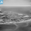
EAW022173 ENGLAND (1949). The town and the seafront, Selsey, from the south-west, 1949

© Hawlfraint cyfranwyr OpenStreetMap a thrwyddedwyd gan yr OpenStreetMap Foundation. 2026. Trwyddedir y gartograffeg fel CC BY-SA.
Delweddau cyfagos (4)
EAW022173

 0°
0m
0°
0m
EAW022170
 26°
97m
26°
97m
EPW024670
 39°
139m
39°
139m
EAW022172
 143°
191m
143°
191m
Manylion
| Pennawd | [EAW022173] The town and the seafront, Selsey, from the south-west, 1949 |
| Cyfeirnod | EAW022173 |
| Dyddiad | 17-April-1949 |
| Dolen | |
| Enw lle | SELSEY |
| Plwyf | SELSEY |
| Ardal | |
| Gwlad | ENGLAND |
| Dwyreiniad / Gogleddiad | 484670, 92741 |
| Hydred / Lledred | -0.80023199979433, 50.727539060507 |
| Cyfeirnod Grid Cenedlaethol | SZ847927 |
Pinnau
 Ivy House 61 West Street, Selsey Ivy House 61 West Street, Selsey |

C J COLE |
Thursday 27th of June 2024 06:42:11 PM |
| Farthings, 39 West Street, Selsey |
C J COLE |
Thursday 27th of June 2024 06:40:28 PM |
| Known as The Dump when I holidayed at Green Lawns caravan park back in the 60s, an amazing overgrown old sand pit. |
Mike Floate |
Monday 7th of April 2014 05:24:26 PM |
Hi, I have heard of Green Lawns caravan park, but I thought it was near to West Sands caravan part owned by the Bunn family. My parents had a caravan on West sands during the 60's so I have many happy memories of selsey |
Anne Hayden |
Sunday 1st of November 2015 03:32:38 PM |