
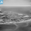
EAW022170 ENGLAND (1949). Selsey Bill and the town, Selsey, from the south-west, 1949

© Hawlfraint cyfranwyr OpenStreetMap a thrwyddedwyd gan yr OpenStreetMap Foundation. 2026. Trwyddedir y gartograffeg fel CC BY-SA.
Delweddau cyfagos (5)
EAW022170

 0°
0m
0°
0m
EPW024670
 65°
49m
65°
49m
EAW022173
 206°
97m
206°
97m
EPW024669
 113°
242m
113°
242m
EAW022172
 163°
252m
163°
252m
Manylion
| Pennawd | [EAW022170] Selsey Bill and the town, Selsey, from the south-west, 1949 |
| Cyfeirnod | EAW022170 |
| Dyddiad | 17-April-1949 |
| Dolen | |
| Enw lle | SELSEY |
| Plwyf | SELSEY |
| Ardal | |
| Gwlad | ENGLAND |
| Dwyreiniad / Gogleddiad | 484712, 92829 |
| Hydred / Lledred | -0.7996167795622, 50.728324207605 |
| Cyfeirnod Grid Cenedlaethol | SZ847928 |
Pinnau
 "The Rookery" (or "Rookery Nook"), Beach Road "The Rookery" (or "Rookery Nook"), Beach Road |

Mazzie |
Saturday 25th of April 2026 11:47:52 AM |
| Danefield Road |
Steve Denne |
Wednesday 25th of August 2021 03:27:02 PM |