
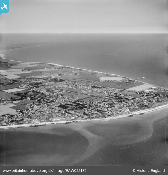
EAW022172 ENGLAND (1949). Selsey Bill and the town, Selsey, from the south-west, 1949
© Hawlfraint cyfranwyr OpenStreetMap a thrwyddedwyd gan yr OpenStreetMap Foundation. 2026. Trwyddedir y gartograffeg fel CC BY-SA.
Delweddau cyfagos (6)
EAW022172
 0°
0m
0°
0m
EAW022175
 136°
145m
136°
145m
EAW022173
 323°
191m
323°
191m
EPW024669
 46°
212m
46°
212m
EAW022170
 343°
252m
343°
252m
EAW022171
 134°
293m
134°
293m
Manylion
| Pennawd | [EAW022172] Selsey Bill and the town, Selsey, from the south-west, 1949 |
| Cyfeirnod | EAW022172 |
| Dyddiad | 17-April-1949 |
| Dolen | |
| Enw lle | SELSEY |
| Plwyf | SELSEY |
| Ardal | |
| Gwlad | ENGLAND |
| Dwyreiniad / Gogleddiad | 484784, 92587 |
| Hydred / Lledred | -0.79865242352655, 50.726137705399 |
| Cyfeirnod Grid Cenedlaethol | SZ848926 |
Pinnau
 my grandparents owned this house in the late 90's my grandparents owned this house in the late 90's |

nathjkent |
Thursday 6th of August 2026 10:02:37 AM |
| PILLBOX (TYPE FW3/26): e59358 |

Matt Aldred edob.mattaldred.com |
Tuesday 16th of September 2025 09:33:19 AM |
| Woodland Road 1949 |
C J COLE |
Sunday 25th of September 2022 02:26:13 PM |
| distinctive shape of St Itha Rd |
Geoff |
Sunday 14th of May 2017 05:10:55 PM |