
EAW010964 ENGLAND (1947). Branksea Castle, Brownsea Island, 1947

© Hawlfraint cyfranwyr OpenStreetMap a thrwyddedwyd gan yr OpenStreetMap Foundation. 2026. Trwyddedir y gartograffeg fel CC BY-SA.
Delweddau cyfagos (10)
EAW010964

EAW010967

EPW000259

EAW010966

EAW010965

EPW000275

EAW010963

EPW000260

EAW019956

EPW041057

Manylion
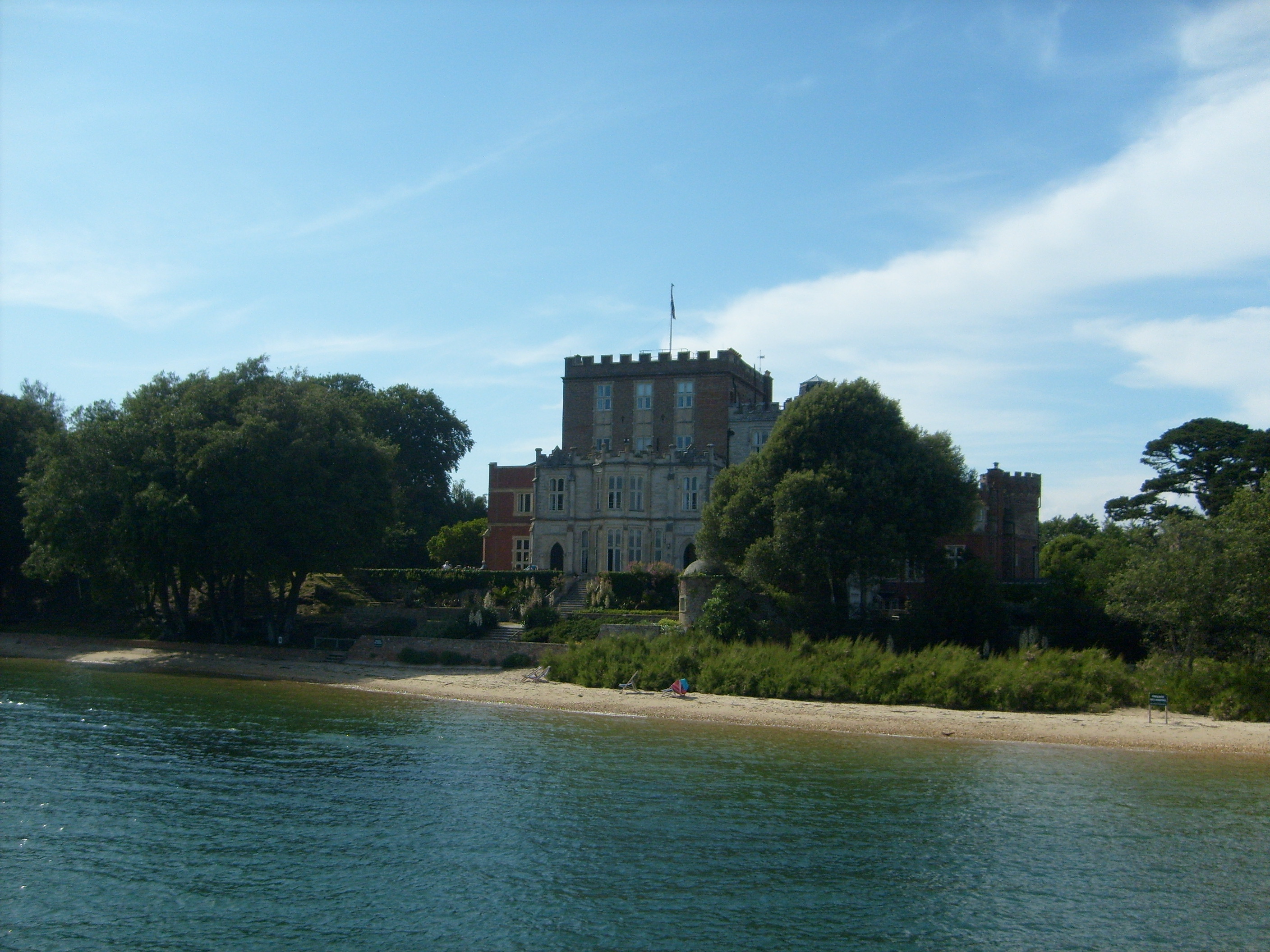
| Pennawd | [EAW010964] Branksea Castle, Brownsea Island, 1947 |
| Cyfeirnod | EAW010964 |
| Dyddiad | 24-September-1947 |
| Dolen | |
| Enw lle | BROWNSEA ISLAND |
| Plwyf | STUDLAND |
| Ardal | |
| Gwlad | ENGLAND |
| Dwyreiniad / Gogleddiad | 403055, 87655 |
| Hydred / Lledred | -1.9567479167757, 50.687961487348 |
| Cyfeirnod Grid Cenedlaethol | SZ031877 |
Pinnau

Matt Aldred edob.mattaldred.com |
Thursday 12th of November 2020 09:12:41 PM | |

redmist |
Sunday 9th of August 2020 09:52:08 AM |
Cyfraniadau Grŵp
Branksea Castle, Brownsea Island, 26/06/2009 |

Class31 |
Tuesday 24th of February 2015 07:33:18 PM |