
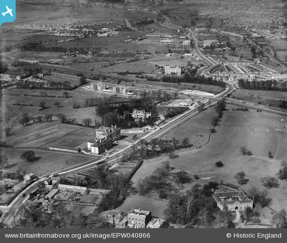
EPW040866 ENGLAND (1933). Hanger Hill and Hanger Lane, Ealing, 1933
© Copyright OpenStreetMap contributors and licensed by the OpenStreetMap Foundation. 2026. Cartography is licensed as CC BY-SA.
Nearby Images (22)
EPW040866

EAW015159

EAW015160

EAW015158

EPW040864

EPW025992

EAW015161

EPW025990

EPW025991

EPW025994

EPW040863

EPW025989

EPW025995

EPW025999

EPW040865

EPW025993

EPW026000

EPW025996

EPW025997

EPW025998

EPW040873

EPW040874

Details
| Title | [EPW040866] Hanger Hill and Hanger Lane, Ealing, 1933 |
| Reference | EPW040866 |
| Date | March-1933 |
| Link | |
| Place name | EALING |
| Parish | |
| District | |
| Country | ENGLAND |
| Easting / Northing | 518498, 182368 |
| Longitude / Latitude | -0.29160794723611, 51.527294002081 |
| National Grid Reference | TQ185824 |
Pins
 |

Leslie B |
Tuesday 23rd of February 2016 04:47:09 PM |

Class31 |
Monday 24th of March 2014 11:52:23 AM | |
|
Class31 |
Monday 24th of March 2014 11:40:39 AM | |
|
Iain Mackinnon |
Thursday 26th of December 2013 01:00:49 PM |