
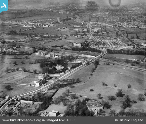
EPW040865 ENGLAND (1933). Hanger Hill, Hanger Lane and environs, Ealing, 1933
© Copyright OpenStreetMap contributors and licensed by the OpenStreetMap Foundation. 2026. Cartography is licensed as CC BY-SA.
Nearby Images (13)
EPW040865

EPW040863

EPW040772

EPW040873

EPW040874

EAW015158

EPW040866

EAW015160

EAW015159

EPW025992

EPW040864

EAW015161

EPW025997

Details
| Title | [EPW040865] Hanger Hill, Hanger Lane and environs, Ealing, 1933 |
| Reference | EPW040865 |
| Date | March-1933 |
| Link | |
| Place name | EALING |
| Parish | |
| District | |
| Country | ENGLAND |
| Easting / Northing | 518419, 182550 |
| Longitude / Latitude | -0.29268514707945, 51.528946478899 |
| National Grid Reference | TQ184826 |
Pins

Leslie B |
Sunday 2nd of December 2018 01:28:48 AM |