
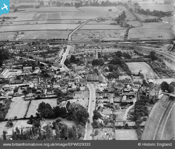
EPW029333 ENGLAND (1929). St Mary's Church and the village centre, Twyford, 1929
© Copyright OpenStreetMap contributors and licensed by the OpenStreetMap Foundation. 2026. Cartography is licensed as CC BY-SA.
Nearby Images (10)
EPW029333

EAW041734

EPW029337

EAW041735

EPW029335

EPW029334

EPW029338

EPW029339

EPW029336

EAW041737

Details
| Title | [EPW029333] St Mary's Church and the village centre, Twyford, 1929 |
| Reference | EPW029333 |
| Date | September-1929 |
| Link | |
| Place name | TWYFORD |
| Parish | TWYFORD |
| District | |
| Country | ENGLAND |
| Easting / Northing | 478820, 175935 |
| Longitude / Latitude | -0.86493435668025, 51.476391391503 |
| National Grid Reference | SU788759 |
Pins
Be the first to add a comment to this image!