
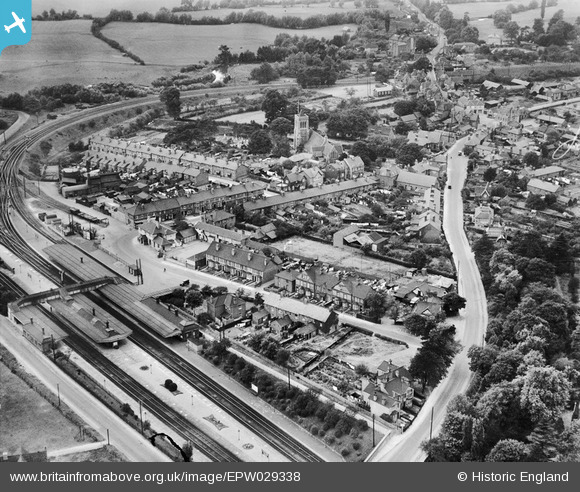
EPW029338 ENGLAND (1929). The railway station, St Mary's Church and environs, Twyford, 1929
© Copyright OpenStreetMap contributors and licensed by the OpenStreetMap Foundation. 2026. Cartography is licensed as CC BY-SA.
Nearby Images (7)
EPW029338

EPW029339

EPW029337

EPW029333

EAW041735

EAW041734

EPW029336

Details
| Title | [EPW029338] The railway station, St Mary's Church and environs, Twyford, 1929 |
| Reference | EPW029338 |
| Date | September-1929 |
| Link | |
| Place name | TWYFORD |
| Parish | TWYFORD |
| District | |
| Country | ENGLAND |
| Easting / Northing | 478980, 175853 |
| Longitude / Latitude | -0.86264906463988, 51.475631827263 |
| National Grid Reference | SU790759 |
