
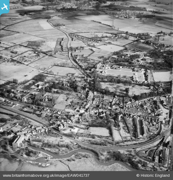
EAW041737 ENGLAND (1952). The village, Twyford, 1952
© Copyright OpenStreetMap contributors and licensed by the OpenStreetMap Foundation. 2026. Cartography is licensed as CC BY-SA.
Nearby Images (6)
EAW041737

EAW041736

EAW041735

EPW029337

EAW041734

EPW029333

Details
| Title | [EAW041737] The village, Twyford, 1952 |
| Reference | EAW041737 |
| Date | 20-February-1952 |
| Link | |
| Place name | TWYFORD |
| Parish | TWYFORD |
| District | |
| Country | ENGLAND |
| Easting / Northing | 478967, 176175 |
| Longitude / Latitude | -0.86276423140125, 51.478528670203 |
| National Grid Reference | SU790762 |
Pins

Rhona |
Monday 30th of August 2021 02:21:37 PM | |
|
Rhona |
Monday 30th of August 2021 02:20:51 PM | |
|
designking |
Friday 9th of August 2019 07:57:46 PM |