
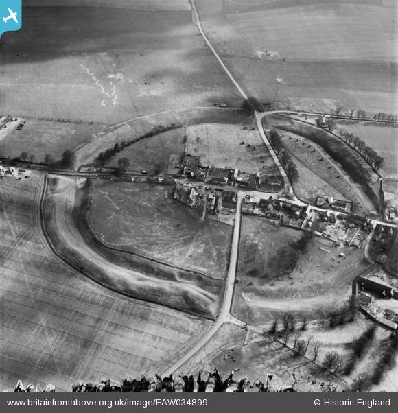
EAW034899 ENGLAND (1951). The henge and village, Avebury, 1951
© Copyright OpenStreetMap contributors and licensed by the OpenStreetMap Foundation. 2026. Cartography is licensed as CC BY-SA.
Nearby Images (15)
EAW034899

EAW007057

EAW034898

EAW007046

EAW007055

EAW034897

EAW007049

EAW007056

EAW007047

EAW007048

EAW007058

EAW049153

EAW049152

EAW049154

EAW049151

Details
| Title | [EAW034899] The henge and village, Avebury, 1951 |
| Reference | EAW034899 |
| Date | 12-March-1951 |
| Link | |
| Place name | AVEBURY |
| Parish | AVEBURY |
| District | |
| Country | ENGLAND |
| Easting / Northing | 410275, 169999 |
| Longitude / Latitude | -1.8521896317365, 51.428411339508 |
| National Grid Reference | SU103700 |
Pins

Class31 |
Tuesday 9th of December 2014 04:00:30 PM |
