
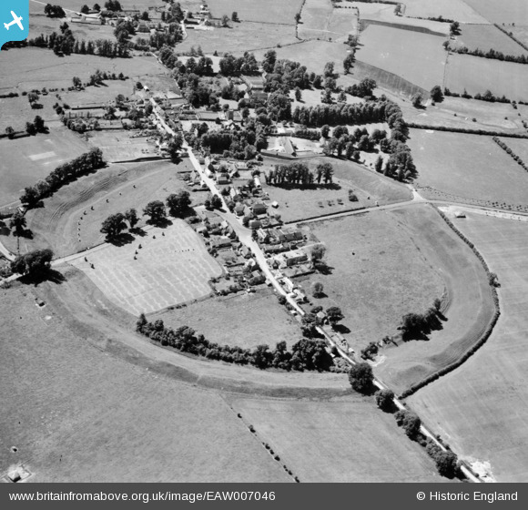
EAW007046 ENGLAND (1947). Avebury Henge and Stone Circles surrounding the village, Avebury, 1947
© Copyright OpenStreetMap contributors and licensed by the OpenStreetMap Foundation. 2026. Cartography is licensed as CC BY-SA.
Nearby Images (16)
EAW007046

EAW034897

EAW007055

EAW007057

EAW034899

EAW034898

EAW007049

EAW007056

EAW007048

EAW007047

EAW007058

EAW049153

EAW049152

EAW049151

EAW049154

EAW007054

Details
| Title | [EAW007046] Avebury Henge and Stone Circles surrounding the village, Avebury, 1947 |
| Reference | EAW007046 |
| Date | 11-June-1947 |
| Link | |
| Place name | AVEBURY |
| Parish | AVEBURY |
| District | |
| Country | ENGLAND |
| Easting / Northing | 410251, 169976 |
| Longitude / Latitude | -1.8525355467748, 51.428204944791 |
| National Grid Reference | SU103700 |
Pins


User Comment Contributions
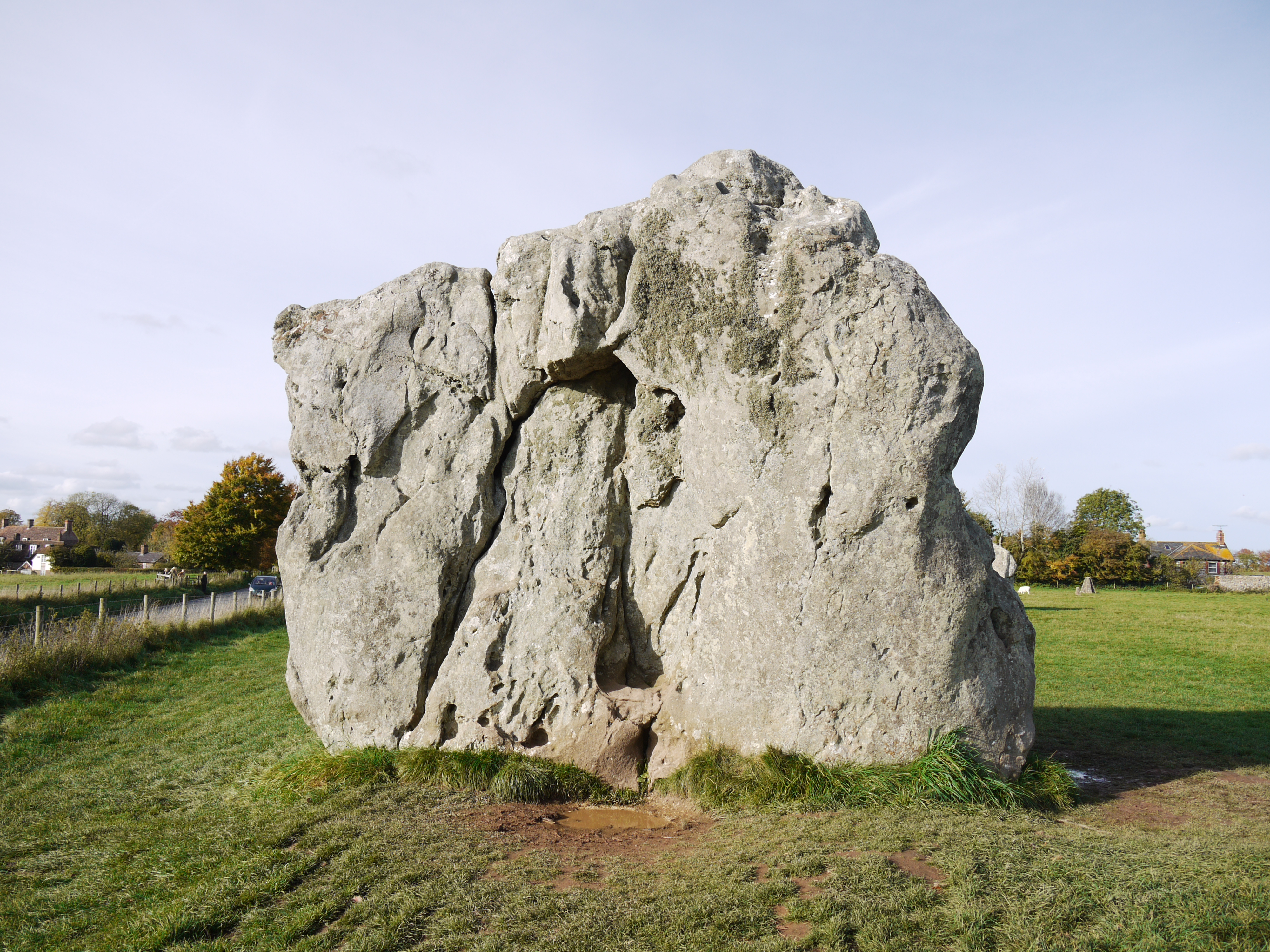
One of the stones, 25/10/2015 |

Class31 |
Tuesday 2nd of February 2016 05:09:21 PM |