
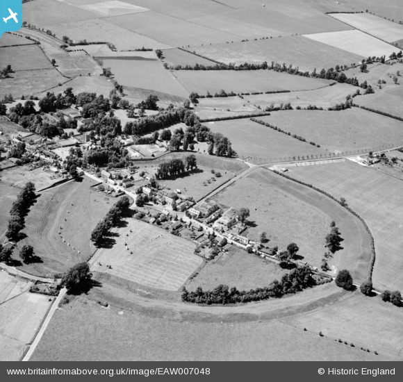
EAW007048 ENGLAND (1947). Avebury Henge and Stone Circles surrounding the village, Avebury, 1947
© Copyright OpenStreetMap contributors and licensed by the OpenStreetMap Foundation. 2026. Cartography is licensed as CC BY-SA.
Nearby Images (16)
EAW007048

EAW007058

EAW007047

EAW049153

EAW049152

EAW007056

EAW007057

EAW034897

EAW007046

EAW034899

EAW007055

EAW007049

EAW034898

EPW011118

EAW007054

EAW049151

Details
| Title | [EAW007048] Avebury Henge and Stone Circles surrounding the village, Avebury, 1947 |
| Reference | EAW007048 |
| Date | 11-June-1947 |
| Link | |
| Place name | AVEBURY |
| Parish | AVEBURY |
| District | |
| Country | ENGLAND |
| Easting / Northing | 410161, 170060 |
| Longitude / Latitude | -1.8538278155373, 51.428961943555 |
| National Grid Reference | SU102701 |
Pins

MB |
Sunday 15th of June 2014 10:19:01 PM | |
|
MB |
Sunday 15th of June 2014 10:08:07 PM | |
|
MB |
Sunday 15th of June 2014 10:05:22 PM | |
|
MB |
Sunday 15th of June 2014 10:03:40 PM | |
|
MB |
Sunday 15th of June 2014 10:02:40 PM | |
|
MB |
Sunday 15th of June 2014 09:56:39 PM | |
|
MB |
Sunday 15th of June 2014 09:55:33 PM | |
|
MB |
Sunday 15th of June 2014 09:51:32 PM | |
|
MB |
Sunday 15th of June 2014 09:44:47 PM |


