
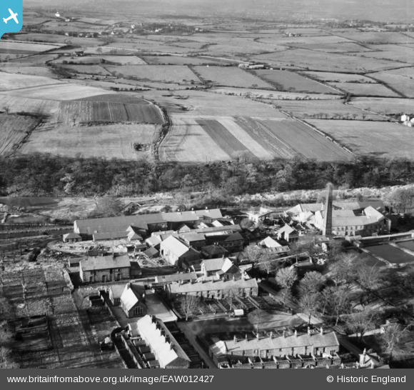
EAW012427 ENGLAND (1947). The Wiggins, Teape and Co Paper Mill and the surrounding countryside, Withnell Fold, from the south-east, 1947
© Copyright OpenStreetMap contributors and licensed by the OpenStreetMap Foundation. 2026. Cartography is licensed as CC BY-SA.
Nearby Images (13)
EAW012427

EAW010390

EAW010159

EAW012428

EAW012426

EAW012425

EAW012429

EAW010161

EAW010160

EAW010388

EAW010389

EAW012422

EAW012424

Details
| Title | [EAW012427] The Wiggins, Teape and Co Paper Mill and the surrounding countryside, Withnell Fold, from the south-east, 1947 |
| Reference | EAW012427 |
| Date | 26-November-1947 |
| Link | |
| Place name | WITHNELL FOLD |
| Parish | WITHNELL |
| District | |
| Country | ENGLAND |
| Easting / Northing | 361157, 423082 |
| Longitude / Latitude | -2.5884472892329, 53.702498123988 |
| National Grid Reference | SD612231 |
Pins
Be the first to add a comment to this image!