
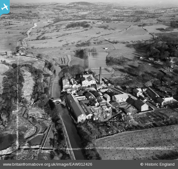
EAW012426 ENGLAND (1947). The Wiggins, Teape and Co Paper Mill, Withnell Fold, from the south-west, 1947. This image was marked by Aerofilms Ltd for photo editing.
© Copyright OpenStreetMap contributors and licensed by the OpenStreetMap Foundation. 2026. Cartography is licensed as CC BY-SA.
Nearby Images (9)
EAW012426

EAW012425

EAW012427

EAW012428

EAW012429

EAW010390

EAW010159

EAW010161

EAW010388

Details
| Title | [EAW012426] The Wiggins, Teape and Co Paper Mill, Withnell Fold, from the south-west, 1947. This image was marked by Aerofilms Ltd for photo editing. |
| Reference | EAW012426 |
| Date | 26-November-1947 |
| Link | |
| Place name | WITHNELL FOLD |
| Parish | WITHNELL |
| District | |
| Country | ENGLAND |
| Easting / Northing | 361050, 423080 |
| Longitude / Latitude | -2.5900679267472, 53.702472174248 |
| National Grid Reference | SD611231 |
