
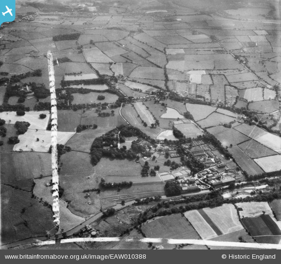
EAW010388 ENGLAND (1947). Withnell Fold Hall, the Paper Mills and the village, Withnell Fold, from the north-west, 1947. This image was marked by Aerofilms Ltd for photo editing.
© Copyright OpenStreetMap contributors and licensed by the OpenStreetMap Foundation. 2026. Cartography is licensed as CC BY-SA.
Nearby Images (15)
EAW010388

EAW010161

EAW010160

EAW010389

EAW010390

EAW010159

EAW012424

EAW012428

EAW012429

EAW012423

EAW012422

EAW012425

EAW012427

EAW012421

EAW012426

Details
| Title | [EAW010388] Withnell Fold Hall, the Paper Mills and the village, Withnell Fold, from the north-west, 1947. This image was marked by Aerofilms Ltd for photo editing. |
| Reference | EAW010388 |
| Date | 30-August-1947 |
| Link | |
| Place name | WITHNELL FOLD |
| Parish | WITHNELL |
| District | |
| Country | ENGLAND |
| Easting / Northing | 361272, 423268 |
| Longitude / Latitude | -2.5867284670076, 53.704178563151 |
| National Grid Reference | SD613233 |
Pins
Be the first to add a comment to this image!