
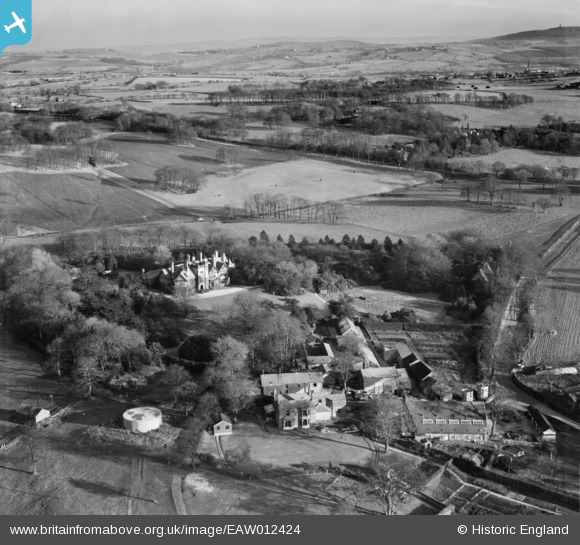
EAW012424 ENGLAND (1947). Withnell Fold Farm and Withnell Fold Hall, Withnell Fold, from the west, 1947
© Copyright OpenStreetMap contributors and licensed by the OpenStreetMap Foundation. 2026. Cartography is licensed as CC BY-SA.
Nearby Images (15)
EAW012424

EAW010389

EAW012422

EAW010160

EAW012423

EAW012421

EAW010159

EAW010161

EAW010388

EAW010163

EAW010390

EAW010162

EAW012427

EAW012428

EAW010164

Details
| Title | [EAW012424] Withnell Fold Farm and Withnell Fold Hall, Withnell Fold, from the west, 1947 |
| Reference | EAW012424 |
| Date | 26-November-1947 |
| Link | |
| Place name | WITHNELL FOLD |
| Parish | WITHNELL |
| District | |
| Country | ENGLAND |
| Easting / Northing | 361383, 423162 |
| Longitude / Latitude | -2.5850337002068, 53.703233985745 |
| National Grid Reference | SD614232 |
Pins

TomRobin |
Tuesday 19th of November 2013 11:46:42 PM |