
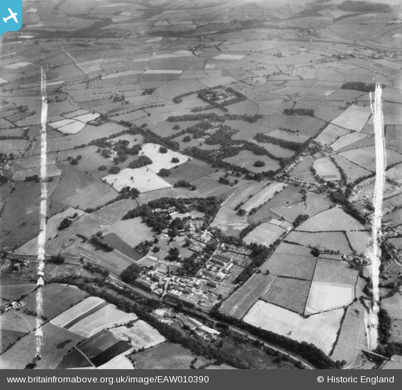
EAW010390 ENGLAND (1947). Withnell Fold Hall, the Paper Mills and the village, Withnell Fold, from the north-west, 1947. This image was marked by Aerofilms Ltd for photo editing.
© Copyright OpenStreetMap contributors and licensed by the OpenStreetMap Foundation. 2026. Cartography is licensed as CC BY-SA.
Nearby Images (14)
EAW010390

EAW010159

EAW010161

EAW012428

EAW012427

EAW012429

EAW010160

EAW012425

EAW010388

EAW012426

EAW010389

EAW012424

EAW012422

EAW012423

Details
| Title | [EAW010390] Withnell Fold Hall, the Paper Mills and the village, Withnell Fold, from the north-west, 1947. This image was marked by Aerofilms Ltd for photo editing. |
| Reference | EAW010390 |
| Date | 30-August-1947 |
| Link | |
| Place name | WITHNELL FOLD |
| Parish | WITHNELL |
| District | |
| Country | ENGLAND |
| Easting / Northing | 361202, 423149 |
| Longitude / Latitude | -2.5877739985976, 53.703103712056 |
| National Grid Reference | SD612231 |
Pins

JohnC |
Thursday 15th of October 2015 02:53:43 PM |