
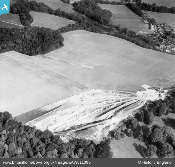
EAW011395 ENGLAND (1947). Quarrying near Surrenden Park and the excavation of a Roman bath house, Little Chart, 1947
© Copyright OpenStreetMap contributors and licensed by the OpenStreetMap Foundation. 2026. Cartography is licensed as CC BY-SA.
Nearby Images (8)
EAW011395

EAW011389

EAW011391

EAW011388

EAW011390

EAW011393

EAW011392

EAW011394

Details
| Title | [EAW011395] Quarrying near Surrenden Park and the excavation of a Roman bath house, Little Chart, 1947 |
| Reference | EAW011395 |
| Date | 1-October-1947 |
| Link | |
| Place name | LITTLE CHART |
| Parish | LITTLE CHART |
| District | |
| Country | ENGLAND |
| Easting / Northing | 593991, 145880 |
| Longitude / Latitude | 0.77577223737144, 51.178672062117 |
| National Grid Reference | TQ940459 |
Pins

nkingdon |
Tuesday 19th of November 2013 10:10:39 AM | |
A bath house according to maps and some reports |
TomRobin |
Tuesday 19th of November 2013 12:48:28 PM |
|
MB |
Wednesday 13th of November 2013 10:20:32 PM | |
|
MB |
Wednesday 13th of November 2013 10:19:50 PM | |
|
MB |
Wednesday 13th of November 2013 10:19:13 PM | |
|
MB |
Wednesday 13th of November 2013 10:17:18 PM | |
|
MB |
Wednesday 13th of November 2013 10:16:51 PM | |
|
MB |
Wednesday 13th of November 2013 10:16:14 PM | |
Archeaology it would appear |
TomRobin |
Tuesday 19th of November 2013 12:49:59 PM |
|
MB |
Wednesday 13th of November 2013 10:15:15 PM |
User Comment Contributions
looking northeast to Little Chart, Kent |
c |
Tuesday 7th of January 2014 01:44:02 PM |
Thanks! We'll update the catalogue and post the new data here in due course. Yours, Katy Britain from Above Cataloguing Team Leader |
Katy Whitaker |
Tuesday 7th of January 2014 01:44:02 PM |
In the same set - eaw011388, eaw011389, eaw011390, eaw011391, eaw011392, eaw011393, eaw011394, eaw011395 |
nkingdon |
Wednesday 13th of November 2013 10:12:13 PM |