
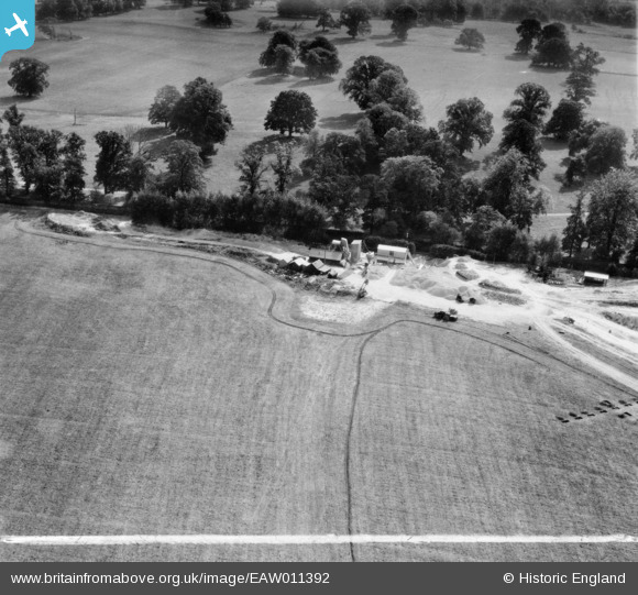
EAW011392 ENGLAND (1947). Quarrying near Surrenden Park, Little Chart, 1947. This image was marked by Aerofilms Ltd for photo editing.
© Copyright OpenStreetMap contributors and licensed by the OpenStreetMap Foundation. 2026. Cartography is licensed as CC BY-SA.
Nearby Images (8)
EAW011392

EAW011394

EAW011393

EAW011390

EAW011388

EAW011391

EAW011389

EAW011395

Details
| Title | [EAW011392] Quarrying near Surrenden Park, Little Chart, 1947. This image was marked by Aerofilms Ltd for photo editing. |
| Reference | EAW011392 |
| Date | 1-October-1947 |
| Link | |
| Place name | LITTLE CHART |
| Parish | LITTLE CHART |
| District | |
| Country | ENGLAND |
| Easting / Northing | 594105, 145759 |
| Longitude / Latitude | 0.77733602819258, 51.177546496076 |
| National Grid Reference | TQ941458 |
Pins

nkingdon |
Wednesday 13th of November 2013 09:59:44 PM |
User Comment Contributions
looking south to Surrenden Park, Little Chart, Kent. The line around the field is made by the ploughman before ploughing to mark out his headland where he lifts out his plough. |
c |
Tuesday 7th of January 2014 01:41:42 PM |
Thanks c. We'll update the catalogue and post the new data here in due course. Yours, Katy Britain from Above Cataloguing Team Leader |
Katy Whitaker |
Tuesday 7th of January 2014 01:41:42 PM |
In the same set - eaw011388, eaw011389, eaw011390, eaw011391, eaw011392, eaw011393, eaw011394, eaw011395 |
nkingdon |
Wednesday 13th of November 2013 10:09:28 PM |