
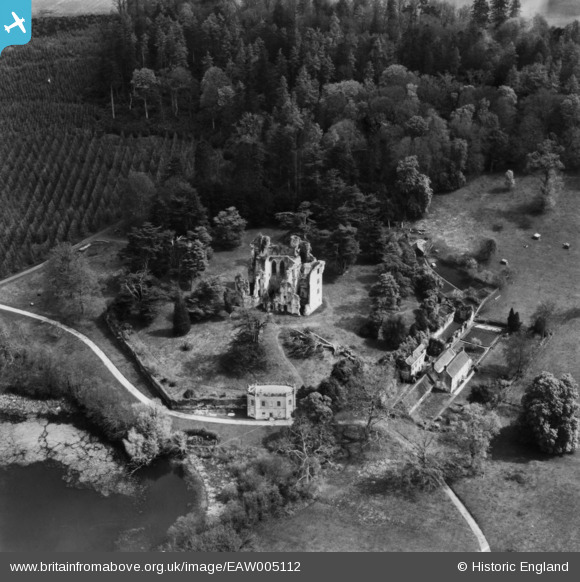
EAW005112 ENGLAND (1947). Old Wardour Castle and House, Wardour, 1947. This image has been produced from a print.
© Copyright OpenStreetMap contributors and licensed by the OpenStreetMap Foundation. 2026. Cartography is licensed as CC BY-SA.
Nearby Images (11)
EAW005112

EAW005110

EAW005109

EAW005111

EAW005113

EAW005107

EAW005106

EAW023181

EAW023180

EAW023178

EAW023179

Details
| Title | [EAW005112] Old Wardour Castle and House, Wardour, 1947. This image has been produced from a print. |
| Reference | EAW005112 |
| Date | 7-September-1947 |
| Link | |
| Place name | WARDOUR |
| Parish | TISBURY |
| District | |
| Country | ENGLAND |
| Easting / Northing | 393862, 126323 |
| Longitude / Latitude | -2.0875493722158, 51.035696992656 |
| National Grid Reference | ST939263 |
Pins
Be the first to add a comment to this image!