Skip to main content
Prydain oddi Fry
Cymraeg
|
English
Mewngofnod
|
Cofrestru
Toggle navigation
Hafan
Gwaddol
Ynghylch
Map
Orielau
Grwpiau
Cymorth
Chwilio
Pob Gwlad (96344)
Lloegr (82521)
Yr Alban (6398)
Cymru (4321)
Gweddill y Byd (3104)
Gwlad Belg (7)
Ffrainc (27)
yr Almaen (2)
Guernsey (116)
Iran (8)
Irac (6)
Iwerddon (1466)
Ynys Manaw (75)
Jersey (122)
yr Iseldiroedd (20)
Northern Ireland (1163)
Sbaen (9)
y Swisdir (26)
Gweithgaredd Diweddaraf
Saved Images
Pagination
First page
first
Previous page
previous
…
Tudalen
16
Tudalen
17
Tudalen
18
Tudalen
19
Current page
20
Tudalen
21
Tudalen
22
Tudalen
23
Tudalen
24
…
Next page
next
Last page
last
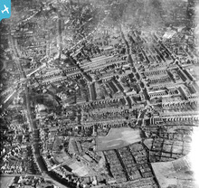
[EPW020030] Merridale and environs, Wolverhampton, 1927
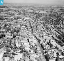
[EAW022955] The High Street, Sutton, from the south, 1949
[EAW022945] Manor Lane, Lodge Road and the High Street, Sutton, 1949
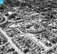
[EPW023511] The High Street and environs, Egham, 1928
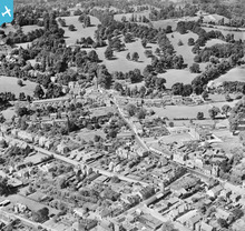
[EPW053660] Church Road, Broad Street and environs, Teddington, 1937
[SPW060074] Dundee, general view, showing Steeple Church, Nethergate and Dudhope Park. An oblique aerial photograph taken facing west.
[EAW000156] The town and the Hampton Pumping Station, Hampton, 1946
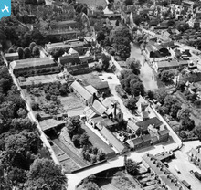
[EAW008125] Brewery and malt house buildings between Barnack Road and Water Street, Stamford, 1947
Pagination
First page
first
Previous page
previous
…
Tudalen
16
Tudalen
17
Tudalen
18
Tudalen
19
Current page
20
Tudalen
21
Tudalen
22
Tudalen
23
Tudalen
24
…
Next page
next
Last page
last
This user has had no activity in the last year.