Skip to main content
Prydain oddi Fry
Cymraeg
|
English
Mewngofnod
|
Cofrestru
Toggle navigation
Hafan
Gwaddol
Ynghylch
Map
Orielau
Grwpiau
Cymorth
Chwilio
Pob Gwlad (96344)
Lloegr (82521)
Yr Alban (6398)
Cymru (4321)
Gweddill y Byd (3104)
Gwlad Belg (7)
Ffrainc (27)
yr Almaen (2)
Guernsey (116)
Iran (8)
Irac (6)
Iwerddon (1466)
Ynys Manaw (75)
Jersey (122)
yr Iseldiroedd (20)
Northern Ireland (1163)
Sbaen (9)
y Swisdir (26)
Gweithgaredd Diweddaraf
Saved Images
Pagination
First page
first
Previous page
previous
…
Tudalen
14
Tudalen
15
Tudalen
16
Tudalen
17
Current page
18
Tudalen
19
Tudalen
20
Tudalen
21
Tudalen
22
…
Next page
next
Last page
last
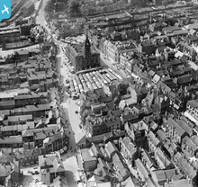
[EPW021084] The Town Centre, Chesterfield, 1928
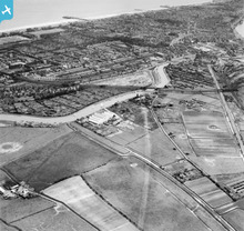
[EAW016547] Chemical Manure Works off North River Road, the River Bure and town, Runham Vauxhall, from the north-west, 1948
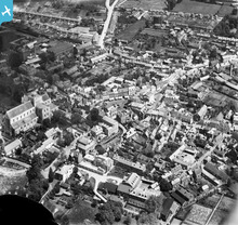
[EPW032325] The Abbey Church of St Mary and the town centre, Romsey, 1930
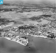
[EAW018152] Lower Hamworthy, Old Town and Holes Bay, Poole, from the south-east, 1948
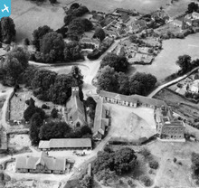
[EAW010587] St Mary's Church, the Manor House and village, Buriton, 1947
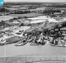
[EAW018474] The Rowhedge Ironworks Co Shipbuilding Yard, Rowhedge, from the north-east, 1948. This image was marked by Aerofilms Ltd for photo editing.
[EPW047626] Brownhills Tile Works, Tunstall, 1935
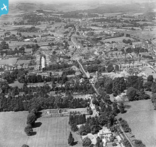
[EPW039718] The town and surrounding countryside, Havant, from the south-east, 1932
Pagination
First page
first
Previous page
previous
…
Tudalen
14
Tudalen
15
Tudalen
16
Tudalen
17
Current page
18
Tudalen
19
Tudalen
20
Tudalen
21
Tudalen
22
…
Next page
next
Last page
last
This user has had no activity in the last year.