
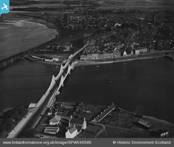
SPW040585 SCOTLAND (1932). Montrose, general view, showing Montrose Bridge and Wharf Street. An oblique aerial photograph taken facing north. This image has been produced from a print.
© Hawlfraint cyfranwyr OpenStreetMap a thrwyddedwyd gan yr OpenStreetMap Foundation. 2026. Trwyddedir y gartograffeg fel CC BY-SA.
Delweddau cyfagos (3)
SPW040585

SAW051247

SPW040586

Manylion
| Pennawd | [SPW040585] Montrose, general view, showing Montrose Bridge and Wharf Street. An oblique aerial photograph taken facing north. This image has been produced from a print. |
| Cyfeirnod | SPW040585 |
| Dyddiad | 1932 |
| Dolen | NRHE Collection item 1315571 |
| Enw lle | |
| Plwyf | MONTROSE |
| Ardal | ANGUS |
| Gwlad | SCOTLAND |
| Dwyreiniad / Gogleddiad | 371067, 757340 |
| Hydred / Lledred | -2.4726203594106, 56.706997487405 |
| Cyfeirnod Grid Cenedlaethol | NO711573 |
Pinnau
Byddwch y cyntaf i ychwanegu sylw at y ddelwedd hon!