
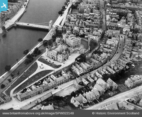
SPW022148 SCOTLAND (1928). Inverness Castle, Castle Hill, Castle Wynd, Inverness. An oblique aerial photograph taken facing north-west.
© Hawlfraint cyfranwyr OpenStreetMap a thrwyddedwyd gan yr OpenStreetMap Foundation. 2026. Trwyddedir y gartograffeg fel CC BY-SA.
Delweddau cyfagos (19)
SPW022148

SAW003579

SPW022144

SPW040500

SPW022146

SPW022149

SPW033826

SPW040499

SPW040498

SPW033829

SAW022606

SAW022607

SAW022609

SAW022605

SAW022608

SAW022604

SPW033833

SPW022145

SPW033825

Manylion
| Pennawd | [SPW022148] Inverness Castle, Castle Hill, Castle Wynd, Inverness. An oblique aerial photograph taken facing north-west. |
| Cyfeirnod | SPW022148 |
| Dyddiad | 1928 |
| Dolen | NRHE Collection item 1256517 |
| Enw lle | |
| Plwyf | INVERNESS AND BONA |
| Ardal | INVERNESS |
| Gwlad | SCOTLAND |
| Dwyreiniad / Gogleddiad | 266653, 845096 |
| Hydred / Lledred | -4.2240492421954, 57.476698989314 |
| Cyfeirnod Grid Cenedlaethol | NH667451 |
Pinnau

oldhall |
Monday 4th of November 2013 04:18:05 PM |