
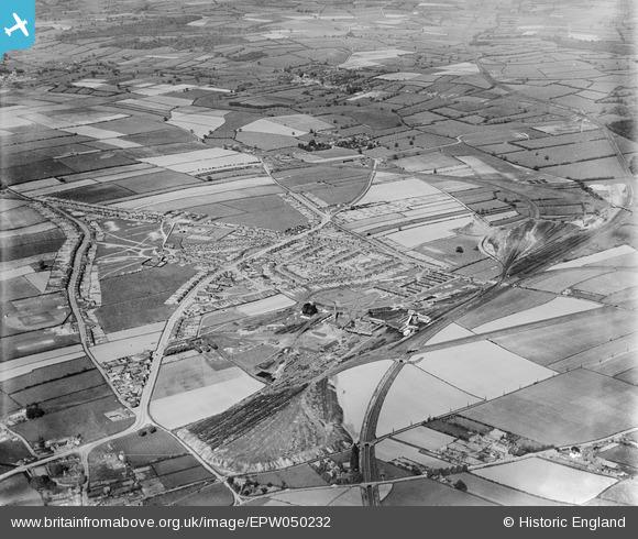
EPW050232 ENGLAND (1936). The Ollerton Colliery, housing at New Ollerton and surrounding countryside, Ollerton, 1936
© Hawlfraint cyfranwyr OpenStreetMap a thrwyddedwyd gan yr OpenStreetMap Foundation. 2026. Trwyddedir y gartograffeg fel CC BY-SA.
Delweddau cyfagos (5)
EPW050232

EPW050234

EPW050230

EPW050231

EPW050238

Manylion
| Pennawd | [EPW050232] The Ollerton Colliery, housing at New Ollerton and surrounding countryside, Ollerton, 1936 |
| Cyfeirnod | EPW050232 |
| Dyddiad | May-1936 |
| Dolen | |
| Enw lle | OLLERTON |
| Plwyf | OLLERTON AND BOUGHTON |
| Ardal | |
| Gwlad | ENGLAND |
| Dwyreiniad / Gogleddiad | 466691, 367810 |
| Hydred / Lledred | -1.0014518007443, 53.202890297044 |
| Cyfeirnod Grid Cenedlaethol | SK667678 |
Pinnau

AngelT |
Saturday 19th of October 2024 12:02:13 AM | |

Whitwellian |
Monday 10th of March 2014 09:44:24 PM | |
|
Mylightweight |
Wednesday 8th of January 2014 09:40:22 AM |