
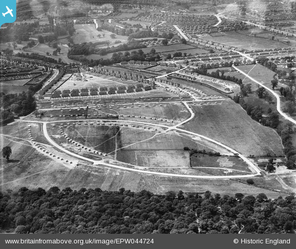
EPW044724 ENGLAND (1934). The Albany Park Estate under construction centred upon Murchison, Dorchester and Crofton Avenues, Bexley Woods, from the north-west, 1934
© Hawlfraint cyfranwyr OpenStreetMap a thrwyddedwyd gan yr OpenStreetMap Foundation. 2026. Trwyddedir y gartograffeg fel CC BY-SA.
Delweddau cyfagos (9)
EPW044724

EPW044374

EPW044373

EPW044722

EPW044721

EPW044371

EPW044723

EPW044375

EPW040884

Manylion
| Pennawd | [EPW044724] The Albany Park Estate under construction centred upon Murchison, Dorchester and Crofton Avenues, Bexley Woods, from the north-west, 1934 |
| Cyfeirnod | EPW044724 |
| Dyddiad | June-1934 |
| Dolen | |
| Enw lle | BEXLEY WOODS |
| Plwyf | |
| Ardal | |
| Gwlad | ENGLAND |
| Dwyreiniad / Gogleddiad | 547826, 173530 |
| Hydred / Lledred | 0.12723225207205, 51.440956598524 |
| Cyfeirnod Grid Cenedlaethol | TQ478735 |
Pinnau
Byddwch y cyntaf i ychwanegu sylw at y ddelwedd hon!