
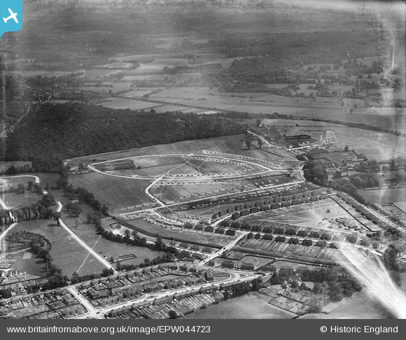
EPW044723 ENGLAND (1934). The Albany Park Estate under construction centred upon Dorchester and Crofton Avenues, Bexley Woods, from the north-west, 1934
© Hawlfraint cyfranwyr OpenStreetMap a thrwyddedwyd gan yr OpenStreetMap Foundation. 2026. Trwyddedir y gartograffeg fel CC BY-SA.
Delweddau cyfagos (9)
EPW044723

EPW044372

EPW044375

EPW044373

EPW044371

EPW044722

EPW038432

EPW040884

EPW044724

Manylion
| Pennawd | [EPW044723] The Albany Park Estate under construction centred upon Dorchester and Crofton Avenues, Bexley Woods, from the north-west, 1934 |
| Cyfeirnod | EPW044723 |
| Dyddiad | June-1934 |
| Dolen | |
| Enw lle | BEXLEY WOODS |
| Plwyf | |
| Ardal | |
| Gwlad | ENGLAND |
| Dwyreiniad / Gogleddiad | 547593, 173552 |
| Hydred / Lledred | 0.1238910088777, 51.441215068344 |
| Cyfeirnod Grid Cenedlaethol | TQ476736 |
Pinnau
Byddwch y cyntaf i ychwanegu sylw at y ddelwedd hon!