
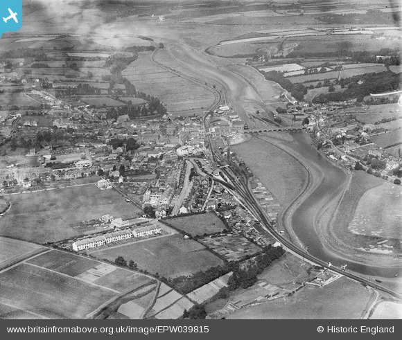
EPW039815 ENGLAND (1932). The town alongside the River Camel, Wadebridge, 1932
© Hawlfraint cyfranwyr OpenStreetMap a thrwyddedwyd gan yr OpenStreetMap Foundation. 2026. Trwyddedir y gartograffeg fel CC BY-SA.
Delweddau cyfagos (6)
EPW039815

EPW033052

EPW039812

EPW033048

EPW039814

EPW033049

Manylion
| Pennawd | [EPW039815] The town alongside the River Camel, Wadebridge, 1932 |
| Cyfeirnod | EPW039815 |
| Dyddiad | August-1932 |
| Dolen | |
| Enw lle | WADEBRIDGE |
| Plwyf | WADEBRIDGE |
| Ardal | |
| Gwlad | ENGLAND |
| Dwyreiniad / Gogleddiad | 199114, 72228 |
| Hydred / Lledred | -4.8339020954941, 50.514723164047 |
| Cyfeirnod Grid Cenedlaethol | SW991722 |
Pinnau
Byddwch y cyntaf i ychwanegu sylw at y ddelwedd hon!