
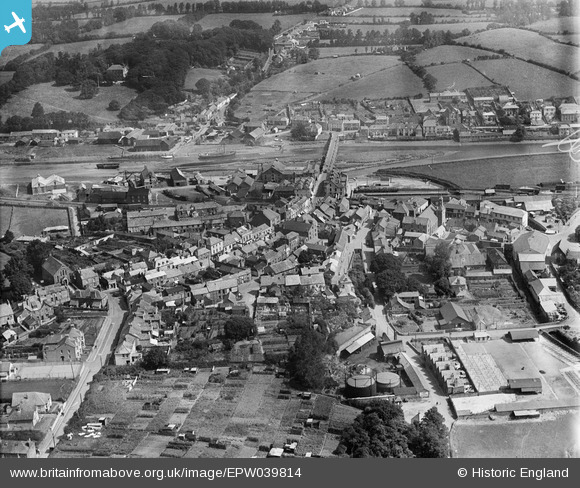
EPW039814 ENGLAND (1932). Molesworth Street, the Cattle Market and the town alongside the River Camel, Wadebridge, 1932
© Hawlfraint cyfranwyr OpenStreetMap a thrwyddedwyd gan yr OpenStreetMap Foundation. 2026. Trwyddedir y gartograffeg fel CC BY-SA.
Delweddau cyfagos (6)
EPW039814

EPW039812

EPW033052

EPW039813

EPW033049

EPW039815

Manylion
| Pennawd | [EPW039814] Molesworth Street, the Cattle Market and the town alongside the River Camel, Wadebridge, 1932 |
| Cyfeirnod | EPW039814 |
| Dyddiad | August-1932 |
| Dolen | |
| Enw lle | WADEBRIDGE |
| Plwyf | WADEBRIDGE |
| Ardal | |
| Gwlad | ENGLAND |
| Dwyreiniad / Gogleddiad | 198940, 72344 |
| Hydred / Lledred | -4.8364160093521, 50.515705450218 |
| Cyfeirnod Grid Cenedlaethol | SW989723 |
Pinnau

ronS |
Saturday 24th of August 2013 02:27:08 AM |