
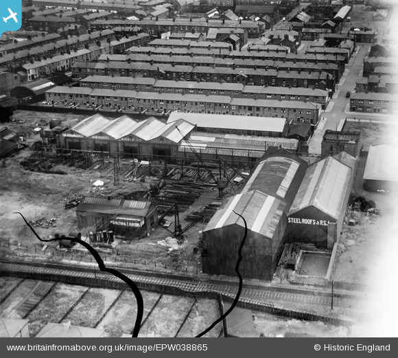
EPW038865 ENGLAND (1932). Thomas Blackburn and Sons Ltd and environs, Preston, 1932. This image has been produced from a damaged negative.
© Hawlfraint cyfranwyr OpenStreetMap a thrwyddedwyd gan yr OpenStreetMap Foundation. 2026. Trwyddedir y gartograffeg fel CC BY-SA.
Delweddau cyfagos (23)
EPW038865

EPW038864

EPW038863

EPW038862

EPW038866

EPW038858

EPW038859

EPW038860

EPW038861

EAW025995

EAW025999

EAW025998

EPW056722

EAW025994

EPW026294

EPW056725

EPW056723

EPW056724

EPW056721

EPW056720

EPW026295

EAW025997

EPW026292

Manylion
| Pennawd | [EPW038865] Thomas Blackburn and Sons Ltd and environs, Preston, 1932. This image has been produced from a damaged negative. |
| Cyfeirnod | EPW038865 |
| Dyddiad | July-1932 |
| Dolen | |
| Enw lle | PRESTON |
| Plwyf | |
| Ardal | |
| Gwlad | ENGLAND |
| Dwyreiniad / Gogleddiad | 355249, 430531 |
| Hydred / Lledred | -2.6790216530969, 53.768980268556 |
| Cyfeirnod Grid Cenedlaethol | SD552305 |
Pinnau

Class31 |
Thursday 10th of January 2013 09:33:22 PM | |
|
Class31 |
Thursday 10th of January 2013 09:31:52 PM | |
|
Class31 |
Thursday 10th of January 2013 09:31:18 PM | |
|
Class31 |
Thursday 10th of January 2013 09:30:26 PM | |
|
Class31 |
Thursday 10th of January 2013 09:29:14 PM | |
|
Class31 |
Thursday 10th of January 2013 09:28:09 PM |