
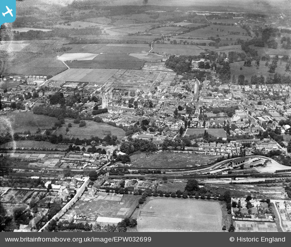
EPW032699 ENGLAND (1930). The town, Farnham, from the south-east, 1930
© Hawlfraint cyfranwyr OpenStreetMap a thrwyddedwyd gan yr OpenStreetMap Foundation. 2026. Trwyddedir y gartograffeg fel CC BY-SA.
Delweddau cyfagos (3)
EPW032699

EPW022726

EPW022728

Manylion
| Pennawd | [EPW032699] The town, Farnham, from the south-east, 1930 |
| Cyfeirnod | EPW032699 |
| Dyddiad | June-1930 |
| Dolen | |
| Enw lle | FARNHAM |
| Plwyf | FARNHAM |
| Ardal | |
| Gwlad | ENGLAND |
| Dwyreiniad / Gogleddiad | 484223, 146367 |
| Hydred / Lledred | -0.79414259387165, 51.209774294103 |
| Cyfeirnod Grid Cenedlaethol | SU842464 |
Pinnau

Kelsing |
Saturday 28th of June 2025 01:48:51 PM | |
|
Kelsing |
Saturday 28th of June 2025 01:47:18 PM | |
|
Kelsing |
Saturday 28th of June 2025 01:45:14 PM | |
|
Bob Paine |
Wednesday 2nd of January 2013 12:38:12 PM | |
|
flubber |
Monday 31st of December 2012 01:45:55 AM | |
|
flubber |
Monday 31st of December 2012 01:45:02 AM | |
|
flubber |
Monday 31st of December 2012 01:43:30 AM |