
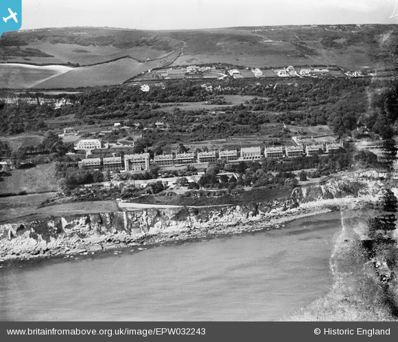
EPW032243 ENGLAND (1930). The Royal National Hospital for Diseases of the Chest and hospital gardens, Ventnor, from the south-east, 1930
© Hawlfraint cyfranwyr OpenStreetMap a thrwyddedwyd gan yr OpenStreetMap Foundation. 2026. Trwyddedir y gartograffeg fel CC BY-SA.
Delweddau cyfagos (13)
EPW032243

EPW032231

EPW032233

EPW032241

EPW043012

EPW032240

EPW032244

EPW032238

EPW032239

EPW032237

EPW032242

EPW022980

EPW000796

Manylion
| Pennawd | [EPW032243] The Royal National Hospital for Diseases of the Chest and hospital gardens, Ventnor, from the south-east, 1930 |
| Cyfeirnod | EPW032243 |
| Dyddiad | June-1930 |
| Dolen | |
| Enw lle | VENTNOR |
| Plwyf | VENTNOR |
| Ardal | |
| Gwlad | ENGLAND |
| Dwyreiniad / Gogleddiad | 454779, 76747 |
| Hydred / Lledred | -1.2261001450347, 50.587294028437 |
| Cyfeirnod Grid Cenedlaethol | SZ548767 |
Pinnau
Byddwch y cyntaf i ychwanegu sylw at y ddelwedd hon!