
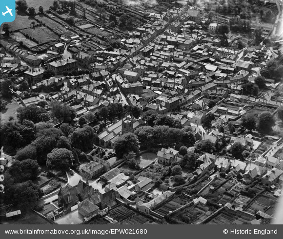
EPW021680 ENGLAND (1928). St Petrock's Church and the town centre, Bodmin, 1928
© Hawlfraint cyfranwyr OpenStreetMap a thrwyddedwyd gan yr OpenStreetMap Foundation. 2026. Trwyddedir y gartograffeg fel CC BY-SA.
Delweddau cyfagos (6)
EPW021680

EPW039806

EPW021681

EPW039804

EPW039809

EPW021684

Manylion
| Pennawd | [EPW021680] St Petrock's Church and the town centre, Bodmin, 1928 |
| Cyfeirnod | EPW021680 |
| Dyddiad | 24-June-1928 |
| Dolen | |
| Enw lle | BODMIN |
| Plwyf | BODMIN |
| Ardal | |
| Gwlad | ENGLAND |
| Dwyreiniad / Gogleddiad | 207254, 67040 |
| Hydred / Lledred | -4.716535281908, 50.470851691094 |
| Cyfeirnod Grid Cenedlaethol | SX073670 |
Pinnau

come2scilly |
Saturday 13th of September 2014 03:52:16 PM |