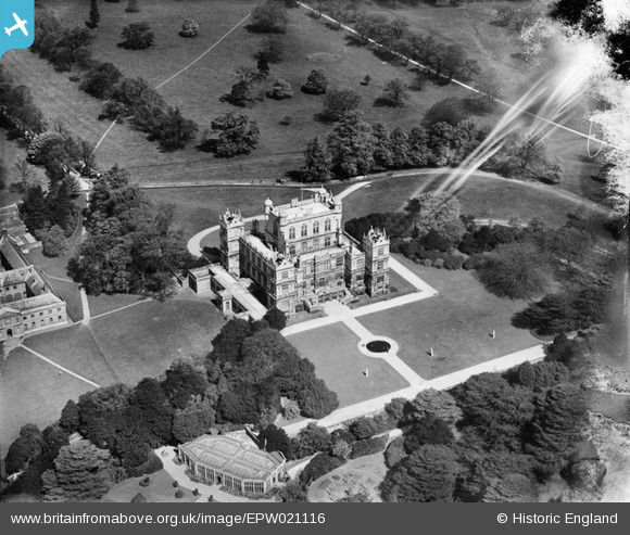
EPW021116 ENGLAND (1928). Wollaton Hall, Wollaton, 1928
    © Hawlfraint cyfranwyr OpenStreetMap a thrwyddedwyd gan yr OpenStreetMap Foundation. 2025. Trwyddedir y gartograffeg fel CC BY-SA.
  
Manylion
| Pennawd | [EPW021116] Wollaton Hall, Wollaton, 1928 | 
| Cyfeirnod | EPW021116 | 
| Dyddiad | May-1928 | 
| Dolen | |
| Enw lle | WOLLATON | 
| Plwyf | |
| Ardal | |
| Gwlad | ENGLAND | 
| Dwyreiniad / Gogleddiad | 453211, 339235 | 
| Hydred / Lledred | -1.2079884712484, 52.947543088165 | 
| Cyfeirnod Grid Cenedlaethol | SK532392 | 
 
             
  ![[EPW021116] Wollaton Hall, Wollaton, 1928](http://britainfromabove.org.uk/sites/all/libraries/aerofilms-images/public/100x100/EPW/021/EPW021116.jpg) 
  
                                          ![[EPW021118] Wollaton Hall, Wollaton, 1928](http://britainfromabove.org.uk/sites/all/libraries/aerofilms-images/public/100x100/EPW/021/EPW021118.jpg) 
 ![[EPW019377] Wollaton Hall and Park, Wollaton, 1927](http://britainfromabove.org.uk/sites/all/libraries/aerofilms-images/public/100x100/EPW/019/EPW019377.jpg) 
 ![[EPW021117] Wollaton Hall and Wollaton Deer Park, Wollaton, from the east, 1928](http://britainfromabove.org.uk/sites/all/libraries/aerofilms-images/public/100x100/EPW/021/EPW021117.jpg) 
  Formal Gardens
 Formal Gardens