
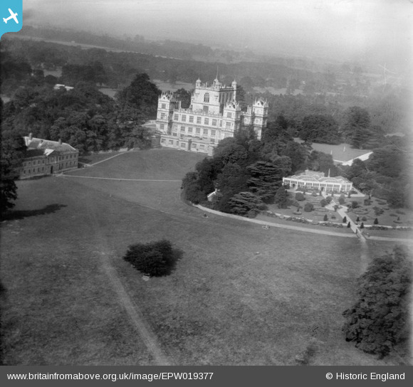
EPW019377 ENGLAND (1927). Wollaton Hall and Park, Wollaton, 1927
© Hawlfraint cyfranwyr OpenStreetMap a thrwyddedwyd gan yr OpenStreetMap Foundation. 2026. Trwyddedir y gartograffeg fel CC BY-SA.
Delweddau cyfagos (4)
EPW019377

EPW021116

EPW021118

EPW021117

Manylion
| Pennawd | [EPW019377] Wollaton Hall and Park, Wollaton, 1927 |
| Cyfeirnod | EPW019377 |
| Dyddiad | September-1927 |
| Dolen | |
| Enw lle | WOLLATON |
| Plwyf | |
| Ardal | |
| Gwlad | ENGLAND |
| Dwyreiniad / Gogleddiad | 453172, 339153 |
| Hydred / Lledred | -1.2085823548349, 52.9468098207 |
| Cyfeirnod Grid Cenedlaethol | SK532392 |
Pinnau
Byddwch y cyntaf i ychwanegu sylw at y ddelwedd hon!