
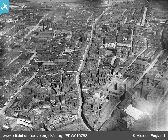
EPW016788 ENGLAND (1926). Yorkshire Street, Rochdale, 1926
© Hawlfraint cyfranwyr OpenStreetMap a thrwyddedwyd gan yr OpenStreetMap Foundation. 2026. Trwyddedir y gartograffeg fel CC BY-SA.
Delweddau cyfagos (3)
EPW016788

EPW016694

EAW022017

Manylion
| Pennawd | [EPW016788] Yorkshire Street, Rochdale, 1926 |
| Cyfeirnod | EPW016788 |
| Dyddiad | August-1926 |
| Dolen | |
| Enw lle | ROCHDALE |
| Plwyf | |
| Ardal | |
| Gwlad | ENGLAND |
| Dwyreiniad / Gogleddiad | 389812, 413646 |
| Hydred / Lledred | -2.1540364508084, 53.619021865669 |
| Cyfeirnod Grid Cenedlaethol | SD898136 |
Pinnau

peter mason |
Monday 16th of December 2024 03:38:36 PM | |
|
peter mason |
Monday 16th of December 2024 03:32:47 PM | |
|
Pete |
Monday 25th of November 2024 10:16:00 PM | |
|
Pete |
Monday 25th of November 2024 10:15:15 PM | |
|
pete |
Sunday 26th of January 2014 07:26:35 PM | |
|
pete |
Sunday 26th of January 2014 07:24:18 PM | |
|
pete |
Sunday 26th of January 2014 07:22:36 PM | |
|
pete |
Sunday 26th of January 2014 07:20:36 PM | |
|
pete |
Sunday 26th of January 2014 07:20:00 PM |