
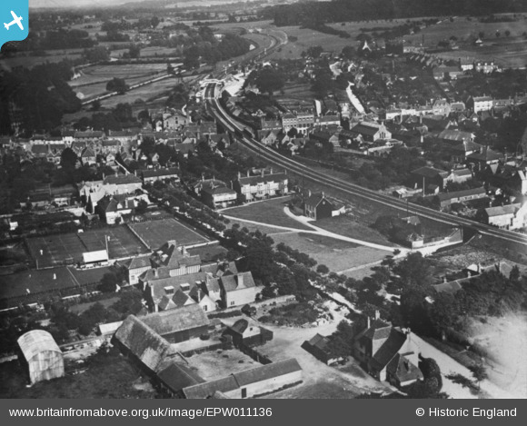
EPW011136 ENGLAND (1924). Church Croft and the town, Hungerford, 1924. This image has been produced from a copy-negative.
© Hawlfraint cyfranwyr OpenStreetMap a thrwyddedwyd gan yr OpenStreetMap Foundation. 2026. Trwyddedir y gartograffeg fel CC BY-SA.
Delweddau cyfagos (4)
EPW011136

EAW022452

EPW011135

EPW011096

Manylion
| Pennawd | [EPW011136] Church Croft and the town, Hungerford, 1924. This image has been produced from a copy-negative. |
| Cyfeirnod | EPW011136 |
| Dyddiad | July-1924 |
| Dolen | |
| Enw lle | HUNGERFORD |
| Plwyf | HUNGERFORD |
| Ardal | |
| Gwlad | ENGLAND |
| Dwyreiniad / Gogleddiad | 433661, 168623 |
| Hydred / Lledred | -1.5159109598688, 51.415131074714 |
| Cyfeirnod Grid Cenedlaethol | SU337686 |
Pinnau

John W |
Friday 24th of March 2017 08:35:49 PM | |
|
John W |
Friday 24th of March 2017 08:35:23 PM | |
|
John W |
Friday 24th of March 2017 08:35:00 PM | |
|
John Wass |
Friday 6th of November 2015 08:47:24 PM |