
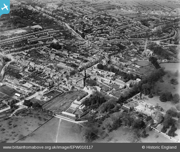
EPW010117 ENGLAND (1924). General view of Swindon from the High Street and environs, Swindon, 1924
© Hawlfraint cyfranwyr OpenStreetMap a thrwyddedwyd gan yr OpenStreetMap Foundation. 2026. Trwyddedir y gartograffeg fel CC BY-SA.
Delweddau cyfagos (7)
EPW010117

EPW059050

EAW006874

EPW059049

EPW010118

EPW010119

EAW006875

Manylion
| Pennawd | [EPW010117] General view of Swindon from the High Street and environs, Swindon, 1924 |
| Cyfeirnod | EPW010117 |
| Dyddiad | April-1924 |
| Dolen | |
| Enw lle | SWINDON |
| Plwyf | |
| Ardal | |
| Gwlad | ENGLAND |
| Dwyreiniad / Gogleddiad | 415805, 183661 |
| Hydred / Lledred | -1.7720268219947, 51.551138924627 |
| Cyfeirnod Grid Cenedlaethol | SU158837 |
Pinnau

NottmJas |
Saturday 16th of September 2023 11:30:43 PM | |
|
NottmJas |
Saturday 16th of September 2023 11:30:16 PM | |
|
NottmJas |
Saturday 16th of September 2023 11:28:26 PM | |
|
NottmJas |
Saturday 16th of September 2023 11:28:04 PM | |
|
gBr |
Friday 3rd of March 2017 03:02:01 PM | |
|
gBr |
Friday 25th of September 2015 03:26:26 PM | |
|
Stuart |
Thursday 6th of June 2013 09:20:17 AM | |
Originally the Corn Exchange |
gBr |
Friday 3rd of March 2017 02:48:19 PM |
|
Stuart |
Thursday 6th of June 2013 09:18:15 AM |